
Career guide
India's Early Warning Systems: Protecting Against — Explained
India is highly vulnerable to extreme weather like cyclones, heatwaves, and floods. Discover how the nation's advanced Early Warning Systems (EWS) work to save lives, minimize damage, and build resilience against nature's forces.
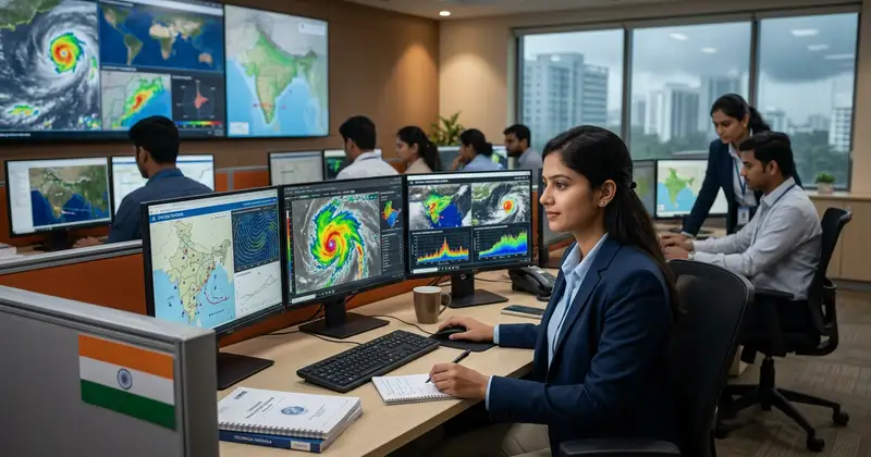
India, a land of incredible geographical diversity, is also highly vulnerable to a range of natural hazards, from devastating cyclones along its vast coastline to scorching heatwaves in its plains and incessant heavy rainfall leading to floods. These extreme weather events pose significant threats to human lives, livelihoods, infrastructure, and the economy. In response, the nation has invested heavily in developing and strengthening its Early Warning Systems (EWS). These systems are crucial for minimizing damage, saving lives, and building resilience against the unpredictable forces of nature.
This article delves into the intricacies of India's EWS for heatwaves, cyclones, and heavy rainfall, exploring their evolution, technological backbone, challenges, and the continuous efforts to make them more robust and effective for every citizen.

Understanding Early Warning Systems (EWS)
An Early Warning System (EWS) is an integrated system of hazard monitoring, forecasting and prediction, disaster risk assessment, communication, and preparedness activities that enable individuals, communities, governments, and businesses to take timely action to reduce disaster risks in advance of hazardous events. Essentially, it's about getting the right information to the right people at the right time, allowing them to act before a disaster strikes.
The core components of an effective EWS, as outlined by the United Nations Office for Disaster Risk Reduction (UNDRR), include:
Disaster Risk Knowledge: Understanding the hazards and vulnerabilities that can lead to disasters. This involves collecting historical data, conducting risk assessments, and mapping vulnerable areas.
Detection, Monitoring, Analysis, and Forecasting: This component involves the scientific and technical processes of observing and predicting hazardous events. For weather-related hazards, this means using meteorological instruments, satellites, radars, and sophisticated computer models.
Warning Dissemination and Communication: Ensuring that timely, understandable, and actionable warnings reach those at risk. This requires robust communication channels, including traditional media, digital platforms, and community-level networks.
Preparedness and Response Capability: The ability of individuals, communities, and organizations to act on the warnings. This includes evacuation plans, emergency shelters, public awareness campaigns, and training for first responders.

Without all four components functioning effectively, an EWS cannot be truly successful. India's journey in disaster management has seen a significant focus on integrating these elements, particularly in the face of escalating climate change impacts.
India's Vulnerability to Extreme Weather Events
India's geographical location, diverse topography, and a large population concentrated in vulnerable areas make it highly susceptible to extreme weather events. The country has a 7,500 km long coastline, making it prone to tropical cyclones. The vast Indo-Gangetic plains and peninsular regions experience intense heatwaves annually, while the monsoon season brings heavy rainfall, often leading to widespread flooding and landslides, especially in the Himalayan region and urban centers.
Climate change is further exacerbating these vulnerabilities. Scientists predict an increase in the frequency and intensity of heatwaves, more erratic monsoon patterns, and stronger, faster-developing cyclones. The economic and human toll of these events can be enormous, disrupting agriculture, displacing communities, and straining public health systems. Recognizing this escalating threat, the Indian government, through agencies like the India Meteorological Department (IMD) and the National Disaster Management Authority (NDMA), has prioritized the development and enhancement of sophisticated EWS. The goal is not just to predict, but to empower communities to respond effectively and build long-term resilience.
EWS for Cyclones: A Success Story
India's journey in cyclone forecasting and warning has been one of significant improvement, transforming from a nation that once suffered catastrophic losses to one with a highly effective system. The devastating Odisha Super Cyclone of 1999, which claimed over 10,000 lives, served as a grim reminder and a catalyst for change. Since then, India has made remarkable strides, particularly in the last two decades.
Key Elements of Cyclone EWS:
Advanced Monitoring Infrastructure: The IMD operates a network of Doppler Weather Radars (DWRs) strategically placed along the coast, providing real-time data on cyclone intensity, track, and landfall. Satellite imagery from INSAT series and international satellites offers continuous surveillance over the oceans.
Sophisticated Forecasting Models: Numerical Weather Prediction (NWP) models, including global and regional models, are used to predict cyclone genesis, intensification, and movement with increasing accuracy.
Multi-Agency Coordination: The IMD is the primary scientific agency, but its warnings are disseminated and acted upon by the National Disaster Management Authority (NDMA), State Disaster Management Authorities (SDMAs), district administrations, and the Indian Navy and Coast Guard.
Coastal Warning Systems: A network of automatic weather stations, tide gauges, and coastal warning sirens (Cyclone Warning Dissemination System - CWDS) ensures that warnings reach fishing communities and coastal residents directly.
Last-Mile Connectivity: Leveraging mobile technology, SMS alerts, social media, and community radio, warnings are disseminated to the remotest villages. Fishermen are equipped with satellite phones and GPS devices.
Evacuation Protocols: Well-defined evacuation plans, community shelters, and regular drills have significantly reduced human casualties. For cyclones like Phailin (2013) and Fani (2019), millions were safely evacuated, dramatically cutting down fatalities to single or double digits.
The success of India's cyclone EWS is a testament to sustained investment in technology, scientific expertise, and robust institutional mechanisms. This model serves as a benchmark for other hazard warning systems.
Battling the Heat: EWS for Heatwaves
Heatwaves, once considered less dramatic than cyclones, have emerged as a silent killer in India, particularly affecting vulnerable populations like the elderly, children, outdoor workers, and those with pre-existing health conditions. The frequency and intensity of heatwaves are projected to rise due to climate change, making a robust EWS critical.
Challenges and Strategies for Heatwave EWS:
Defining Heatwave Criteria: IMD defines a heatwave based on deviations from normal maximum temperatures or absolute maximum temperatures, varying by region. This scientific definition forms the basis of warnings.
Color-Coded Alerts: Similar to other weather phenomena, IMD issues color-coded alerts (Yellow, Orange, Red) for heatwaves, indicating increasing severity and the need for public action. Red alerts signify extreme heat conditions requiring immediate and comprehensive protective measures.
Public Health Advisories: Warnings are accompanied by actionable advice, such as staying hydrated, avoiding direct sun exposure during peak hours, wearing light clothing, and recognizing symptoms of heatstroke. These advisories are disseminated through various media.
State-Level Heat Action Plans (HAPs): Many states, inspired by the Ahmedabad Heat Action Plan (HAP), have developed localized strategies. These HAPs involve inter-agency coordination, early warning dissemination, public awareness campaigns, capacity building for health workers, and providing cooling centers.
Monitoring Urban Heat Islands: Urban areas often experience higher temperatures due to concrete structures and lack of green cover (Urban Heat Island effect). EWS for heatwaves increasingly considers these micro-climates to issue more localized and precise warnings.
Long-Range Forecasts: IMD provides seasonal outlooks for heatwaves, allowing states to prepare in advance.
Despite significant progress, challenges remain in ensuring universal awareness, especially among daily wage earners and rural populations, and in implementing effective cooling solutions. Continuous public education and community engagement are vital for the success of heatwave EWS.
Forecasting the Fury: EWS for Heavy Rainfall and Floods
Heavy rainfall, especially during the monsoon season, is a lifeline for India's agriculture. However, excessive or unseasonal downpours often lead to devastating floods, landslides, and urban inundation. An effective EWS for heavy rainfall and floods is complex due to the localized nature of rainfall and the intricate network of river systems.
Components of Rainfall and Flood EWS:
Rainfall Monitoring: A dense network of rain gauges, Doppler radars, and satellite-based precipitation estimates provide real-time rainfall data.
Hydrological Models: The Central Water Commission (CWC) operates a vast network of flood forecasting stations and uses hydrological models to predict river levels and inundation based on rainfall forecasts and upstream reservoir releases.
Urban Flood Warning Systems: For major cities, specific systems are being developed that integrate rainfall data with urban drainage models to predict localized urban flooding. These often involve IoT sensors in drains and low-lying areas.
Flash Flood Guidance System (FFGS): India, in collaboration with the World Meteorological Organization (WMO), has implemented the FFGS, which provides forecasts for flash floods at the watershed level, crucial for mountainous regions.
Landslide Early Warning: While still evolving, efforts are underway to integrate rainfall forecasts with geological data and soil moisture sensors to predict landslide potential in vulnerable hilly areas.
Dam and Reservoir Management: Coordinated operations between IMD, CWC, and dam authorities ensure timely release of water from reservoirs, balancing irrigation/power needs with flood control, and issuing downstream warnings.
The challenge lies in the sheer scale and complexity of India's river basins and the highly localized nature of heavy rainfall events. Improving spatial resolution of forecasts and enhancing last-mile communication to communities along river banks and in flood-prone urban areas remains a continuous focus.
Technological Advancements Driving EWS in India
The effectiveness of India's EWS has been dramatically boosted by rapid advancements in technology. These innovations are making predictions more accurate, warnings more timely, and dissemination more efficient.
Satellite Technology: India's own INSAT series of satellites provides continuous monitoring of weather patterns, cyclone formation, cloud cover, and rainfall estimation. International satellites complement this data, offering a global perspective.
Doppler Weather Radars (DWRs): The expanding network of DWRs across the country offers real-time, high-resolution data on precipitation intensity, wind velocity, and storm movement, significantly improving short-range forecasts for cyclones and heavy rainfall.
High-Performance Computing (HPC): Supercomputers are essential for running complex Numerical Weather Prediction (NWP) models. India has invested in powerful supercomputers (e.g., Mihir, Pratyush) that can process vast amounts of data to generate more accurate and higher-resolution forecasts.
Artificial Intelligence (AI) and Machine Learning (ML): AI/ML algorithms are increasingly being used to analyze historical weather data, identify patterns, improve forecast accuracy, and even predict localized impacts more effectively. For instance, ML can help in refining heatwave predictions or identifying areas prone to flash floods.
Internet of Things (IoT) Sensors: Networks of IoT sensors are being deployed to collect real-time data on temperature, humidity, rainfall, water levels in rivers and drains. This granular data helps in hyper-local forecasting and monitoring, especially for urban flooding.
Mobile Applications and Digital Platforms: Apps like 'Mausam,' 'Umang,' and various state-specific disaster management apps provide direct access to weather forecasts, warnings, and advisories. Social media platforms are also leveraged for rapid dissemination.
Geographic Information Systems (GIS): GIS technology is used for mapping vulnerable areas, visualizing hazard impacts, and integrating various data layers to create comprehensive risk assessments and aid in evacuation planning.
These technological backbone elements, when integrated effectively, create a powerful system capable of providing increasingly precise and timely warnings, thereby strengthening India's resilience against extreme weather events. Staying updated with these technologies can also be a career path, for instance, in /sarkari-result">Sarkari Result roles related to meteorology or disaster management.
Challenges and Future Directions for EWS in India
While India has made commendable progress in its EWS, several challenges remain, and continuous improvement is essential to adapt to evolving climate patterns and societal needs.
Key Challenges:
Last-Mile Connectivity and Communication: Despite advancements, ensuring that warnings reach every single individual, especially in remote rural areas or marginalized communities, remains a challenge. Language barriers, illiteracy, and lack of access to technology can hinder effective communication.
Multi-Hazard Approach: Most EWS are hazard-specific. There's a need to move towards a more integrated, multi-hazard EWS that can simultaneously warn about various overlapping threats (e.g., heavy rainfall leading to floods and landslides).
Data Integration and Sharing: Different agencies collect vast amounts of data, but seamless integration and real-time sharing between various departments (IMD, CWC, NDMA, health, agriculture, urban local bodies) can be improved for a more holistic approach.
Community Engagement and Awareness: A warning is only effective if people understand it and know how to respond. Continuous public awareness campaigns, drills, and community-level capacity building are crucial to foster a culture of preparedness.
Funding and Infrastructure Maintenance: Sustained investment is required for upgrading infrastructure, maintaining equipment, and training personnel.
Addressing Urban Vulnerabilities: Rapid urbanization often leads to increased vulnerability to urban flooding and heat stress. EWS needs to be tailored to address the unique challenges of dense urban environments.
Climate Change Adaptation: As weather patterns become more extreme and unpredictable, EWS models need to continuously evolve and incorporate the latest climate science to provide accurate long-term projections and short-term warnings.
Future Directions:
Hyper-Local Forecasting: Developing models that can provide highly localized forecasts (e.g., neighborhood-level) for rainfall and temperature.
Impact-Based Forecasting: Moving beyond just predicting 'what' the weather will be, to predicting 'what the weather will do' – i.e., forecasting the likely impacts on specific sectors (agriculture, transport, health).
Leveraging Citizen Science: Engaging citizens in data collection (e.g., through mobile apps for rainfall reporting) can augment official networks.
International Collaboration: Continued collaboration with global meteorological agencies and research institutions to share best practices and advanced technologies.
By addressing these challenges and embracing future directions, India can further strengthen its EWS, making its communities more resilient and safeguarding lives and livelihoods against the increasing threats of extreme weather.
The Role of Government and Public in EWS
The success of India's Early Warning Systems is a collaborative effort, relying heavily on the synergistic functioning of government agencies and the active participation of the public.
Government Agencies:
India Meteorological Department (IMD): As the nodal agency for weather forecasting, IMD is responsible for monitoring, analyzing, and issuing warnings for various meteorological phenomena, including cyclones, heatwaves, and heavy rainfall. Its scientific expertise and technological infrastructure form the backbone of the EWS.
National Disaster Management Authority (NDMA) & State Disaster Management Authorities (SDMAs): These bodies are crucial for translating scientific warnings into actionable advisories, coordinating response efforts, developing disaster management plans, and building capacity at state and district levels. They play a vital role in evacuation planning, setting up shelters, and ensuring relief operations.
Central Water Commission (CWC): For flood forecasting, CWC monitors river levels and reservoir capacities, issuing flood warnings and advisories in coordination with IMD.
Ministry of Health & Family Welfare: Plays a critical role in developing health advisories for heatwaves, managing heat-related illnesses, and ensuring healthcare preparedness.
Local Administration (District Collectors, Panchayats): These are the frontline responders, responsible for disseminating warnings to the last mile, implementing evacuation orders, and coordinating local relief efforts.
Public Participation:
An EWS is only as effective as the public's response to it. Active public participation is paramount:
Staying Informed: Citizens must actively seek out and pay attention to official weather forecasts and warnings from credible sources like IMD, NDMA, and local authorities. This can be through TV, radio, newspapers, official mobile apps (/admit-card">download official apps for timely updates), and social media.
Understanding Warnings: Familiarizing oneself with different types of warnings (e.g., color-coded alerts) and their implications.
Personal and Family Preparedness: Developing a family emergency plan, preparing an emergency kit, identifying safe evacuation routes, and knowing the location of the nearest shelter.
Following Advisories: Adhering to instructions from authorities, such as evacuating when advised, taking precautions during heatwaves, or avoiding flood-prone areas.
Community Engagement: Participating in community-level preparedness programs, drills, and helping neighbors, especially the vulnerable.
Reporting Local Conditions: In some cases, citizens can contribute to EWS by reporting local conditions (e.g., heavy rainfall, rising water levels) to local authorities, which can aid in hyper-local monitoring.
By fostering a culture of preparedness and mutual responsibility, India can significantly enhance its resilience against extreme weather events.
Put this advice into practice
India's journey in developing and strengthening its Early Warning Systems for heatwaves, cyclones, and heavy rainfall is a compelling narrative of scientific advancement, technological integration, and institutional collaboration. From the dramatic improvements in cyclone forecasting that have saved countless lives to the evolving strategies for mitigating heatwave impacts and managing flood risks, the nation has demonstrated a strong commitment to disaster risk reduction. While significant progress has been made, the dynamic nature of climate change and the unique vulnerabilities of a diverse population necessitate continuous innovation. Addressing challenges related to last-mile communication, fostering a truly multi-hazard approach, and ensuring sustained public awareness will be crucial.
As India moves forward, its EWS will continue to evolve, leveraging cutting-edge technology and community engagement to build a more resilient future for all its citizens, safeguarding them against the increasing threats of extreme weather.
Frequently Asked Questions
Q1: What is the primary agency responsible for issuing weather warnings in India?
A: The India Meteorological Department (IMD) is the primary agency responsible for meteorological observations, weather forecasting, and issuing warnings for various weather phenomena, including cyclones, heatwaves, and heavy rainfall, across India.
Q2: How do I know if a heatwave warning has been issued for my area?
A: The IMD issues daily weather bulletins and specific heatwave warnings on its website and through various media channels. You can also check official mobile applications like 'Mausam' or 'Umang,' listen to local news, or follow updates from your State Disaster Management Authority (SDMA). These warnings often use a color-coded system (Yellow, Orange, Red) to indicate severity.
Q3: What role do mobile phones play in India's Early Warning Systems?
A: Mobile phones are crucial for last-mile dissemination of warnings. Government agencies send SMS alerts (e.g., through the Common Alerting Protocol - CAP system) to people in affected areas. Official mobile applications provide detailed forecasts and advisories directly to users. Social media platforms are also used for rapid information sharing during emergencies.
Q4: How accurate are flood forecasts in India?
A
Related Resources
Related Resources
- Careers in Disaster Management
- IMD Recruitment Guide
- Govt Schemes for Climate Resilience
TrueJobs Editorial Team
TrueJobs editorial desk
This article is prepared from the sources referenced in the guide and reviewed for clarity, links and dated information. Read our editorial and corrections policy.
Continue This Topic
Follow the closest earlier and newer coverage so older archive posts keep real contextual crawl paths.
India's Heatwave Forecasting 2026: IMD, Alerts & Key Facts
As heatwaves in India intensify, the India Meteorological Department (IMD) is advancing its forecasting system for 2026. This article explores IMD's enhanced capabilities, new alert systems, and key facts for public preparedness against extreme heat.
Doppler Weather Radar: India's Eye on the Sky Explained
Discover the science behind Doppler Weather Radar, the technology serving as India's frontline defense against severe weather. This guide explains how it works, its critical role in forecasting cyclones and monsoons, and its importance for public safety and the economy.
Read Next

India's Heatwave Forecasting 2026: IMD, Alerts & Key Facts

Doppler Weather Radar: India's Eye on the Sky Explained

India's Cyclone Forecasting 2026: IMD's Unprecedented Accuracy Boost

Mission Mausam 2026: Objectives, Components & Impact
Explore Topics
Perfect Your Resume
Use our AI-powered Resume Builder to create ATS-optimized resumes.
AI Resume Builder