
Career guide
Latest Doppler Weather Radar: India's Eye on the Sky — Explained
Discover the science behind Doppler Weather Radar, the technology serving as India's frontline defense against severe weather. This guide explains how it works, its critical role in forecasting cyclones and monsoons, and its importance for public safety and the economy.
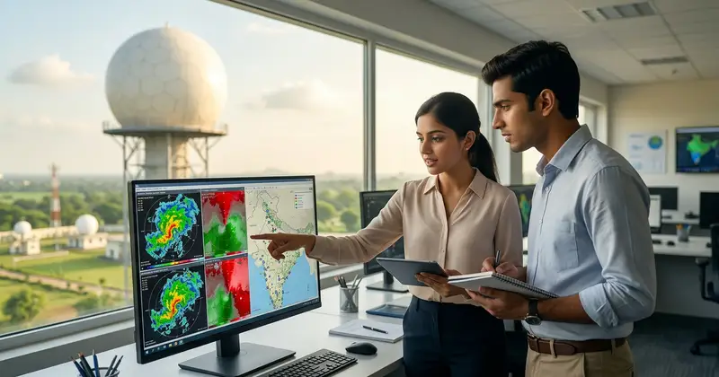
In a country as vast and geographically diverse as India, accurate and timely weather information is not just a convenience; it's a critical component of public safety, economic stability, and disaster preparedness. From the annual monsoon that dictates agricultural fortunes to the devastating cyclones that threaten coastal communities, understanding weather patterns is paramount. At the forefront of this meteorological vigilance stands the Doppler Weather Radar – a sophisticated technology that acts as India's watchful eye on the sky. This article delves into the intricacies of Doppler Weather Radar, exploring its working principles, its myriad uses, and why this vital piece of technology frequently makes headlines, especially in the context of India's robust weather monitoring efforts.

Understanding Doppler Weather Radar: The Basics
At its core, a Doppler Weather Radar is a type of radar used to locate precipitation, calculate its motion, and estimate its type (rain, snow, hail, etc.). Unlike conventional radars that merely detect the presence and intensity of precipitation, Doppler radars leverage the 'Doppler effect' to measure the speed and direction of precipitation particles relative to the radar station. This added capability provides meteorologists with crucial insights into the dynamics of weather systems, allowing for more precise forecasts and early warnings.
The name 'Doppler' comes from Christian Doppler, an Austrian physicist who described the phenomenon in 1842. The Doppler effect refers to the change in frequency or wavelength of a wave (like sound or light) for an observer moving relative to its source. In the context of weather radar, the radar sends out microwave pulses, and when these pulses hit precipitation particles (raindrops, snowflakes, hail), they scatter back to the radar. If the particles are moving towards the radar, the frequency of the reflected waves increases; if they are moving away, the frequency decreases. By measuring this frequency shift, the radar can determine the velocity of the precipitation.
How Doppler Weather Radar Works: A Deep Dive
The operation of a Doppler Weather Radar involves a complex interplay of physics and advanced signal processing. Here's a step-by-step breakdown of its working mechanism:

-
Pulse Transmission:
The radar's transmitter generates short, powerful pulses of microwave energy. These pulses are directed into the atmosphere by a large, rotating parabolic antenna. The antenna continuously scans the sky, typically rotating 360 degrees horizontally and tilting vertically to cover different altitudes.
-
Interaction with Targets:
As the microwave pulses travel through the atmosphere, they encounter various 'targets' – primarily precipitation particles like raindrops, snowflakes, hail, and even dust or insects. When these pulses hit a target, a small portion of the energy is scattered back towards the radar antenna. This scattered energy is known as the 'echo'.
-
Echo Reception:
The radar antenna, after transmitting a pulse, switches to receive mode. It captures the returning echoes, which are significantly weaker than the transmitted pulses. These echoes carry vital information about the targets.
-
Signal Processing and Doppler Shift Measurement:
The received echoes are sent to a highly sensitive receiver and then to a sophisticated signal processor. This processor measures several characteristics of the echo:
- Reflectivity: The strength of the echo, which indicates the intensity of precipitation. Stronger echoes mean heavier rain or larger hail.
- Radial Velocity: This is where the Doppler effect comes into play. The processor compares the frequency of the transmitted pulse with the frequency of the received echo. Any shift in frequency indicates motion of the target towards or away from the radar. This velocity is 'radial' because it's measured along the line of sight from the radar.
- Spectral Width: This indicates the spread of velocities within a given volume of air. High spectral width can suggest turbulence or the presence of different types of precipitation.
-
Data Interpretation and Display:
The processed data is then converted into visual representations that meteorologists can interpret. These include maps showing precipitation intensity (often color-coded), wind shear, and areas of rotation within storms. Advanced algorithms can even differentiate between rain, snow, and hail based on the characteristics of the returned signal, especially with dual-polarization radars.
Key Components of a Doppler Weather Radar System
A typical Doppler Weather Radar system is an intricate assembly of high-tech components working in synergy:
-
Transmitter:
Generates high-power microwave pulses. Modern radars often use solid-state transmitters for better reliability and efficiency.
-
Antenna:
A large, parabolic dish that focuses and directs the microwave pulses into a narrow beam. It also collects the returning echoes. The antenna is mounted on a pedestal that allows it to rotate horizontally (azimuth) and tilt vertically (elevation) to scan the atmosphere.
-
Radome:
A protective dome, usually made of fiberglass, that encloses the antenna. It shields the antenna from harsh weather conditions (wind, rain, ice) while allowing radar signals to pass through with minimal attenuation.
-
Receiver:
A highly sensitive device that detects and amplifies the faint returning echoes.
-
Signal Processor:
The 'brain' of the radar, responsible for analyzing the characteristics of the received signals, calculating reflectivity, velocity, and other parameters. It uses complex algorithms to filter out noise and extract meaningful weather information.
-
Data Acquisition and Display System:
Computers and software that process the raw data into interpretable formats, generating various radar products (e.g., reflectivity maps, velocity maps, storm tracks) for meteorologists and the public.
Primary Uses of Doppler Weather Radar: Beyond Raindrops
The capabilities of Doppler Weather Radar extend far beyond simply telling us if it's raining. Its applications are diverse and crucial for various sectors:
-
Precise Weather Forecasting:
Doppler radar provides real-time data on precipitation intensity, type, and movement, which is essential for short-range forecasts (nowcasting) and improving the accuracy of medium-range predictions. This helps in predicting localized heavy rainfall events.
-
Severe Weather Detection and Warning:
This is arguably its most critical application. Doppler radar can detect:
- Cyclones and Tropical Storms: Tracking the eye wall, estimating rainfall rates, and predicting landfall.
- Thunderstorms: Identifying strong updrafts and downdrafts, and potential for severe lightning.
- Tornadoes: Detecting the characteristic rotating winds (mesocyclones) within severe thunderstorms, providing precious minutes of warning.
- Hail: Differentiating between rain and hail, and estimating hail size.
- Squall Lines and Microbursts: Identifying sudden, strong wind gusts that can be hazardous.
-
Aviation Weather Services:
Aviation relies heavily on radar data to ensure flight safety. Pilots and air traffic controllers use radar information to avoid severe thunderstorms, turbulence, wind shear, and icing conditions, leading to smoother and safer air travel. /admit-card for air traffic control exams often require knowledge of such systems.
-
Hydrology and Flood Forecasting:
Accurate rainfall estimates from radar are fed into hydrological models to predict river levels and potential flooding. This is vital for managing reservoirs, issuing flood warnings, and mitigating disaster impacts, especially during monsoon seasons.
-
Agricultural Planning:
Farmers can use localized rainfall data to make informed decisions about planting, irrigation, and harvesting, optimizing crop yields and reducing losses due to adverse weather.
-
Research and Climate Studies:
Radar data contributes to atmospheric research, helping scientists understand weather phenomena better and improve climate models.
Why Doppler Weather Radar is Crucial for India and Why It's in News
India's unique geographical features and climate patterns make Doppler Weather Radar an indispensable tool for the India Meteorological Department (IMD) and disaster management agencies. The subcontinent is prone to a range of extreme weather events, including:
- Monsoon Rains: The annual monsoon brings life-giving rain but also poses risks of flash floods, landslides, and urban inundation. Precise rainfall monitoring is critical.
- Tropical Cyclones: India's long coastline is frequently battered by cyclones originating in the Bay of Bengal and the Arabian Sea. Early and accurate tracking of these systems is crucial for timely evacuation and minimizing casualties.
- Thunderstorms and Nor'westers: Parts of India, particularly the eastern and northeastern regions, experience severe thunderstorms (Kal Baisakhi or Nor'westers) that can cause significant damage.
- Western Disturbances: These bring winter rains and snow to the northern parts of India, impacting agriculture and causing disruptions.
The significance of Doppler Weather Radar in India is frequently highlighted in the news due to the IMD's ongoing efforts to expand and modernize its radar network. Recent years have seen a concerted push to increase radar coverage across the country, particularly in vulnerable coastal areas and mountainous regions. For instance, the installation of new radars in places like Chennai, Visakhapatnam, Mumbai, and the Himalayas has significantly enhanced the IMD's ability to provide localized and accurate forecasts. These installations are often reported as major steps forward in India's disaster preparedness capabilities.
When a cyclone approaches, news channels extensively feature radar images, showing the storm's progression and intensity. Similarly, during periods of heavy rainfall, radar data is used to pinpoint affected areas and issue alerts. The absence or malfunction of a radar in a critical region can also become news, underscoring its importance. The government's goal to have a comprehensive radar network covering the entire country by a certain timeline is a recurring topic in discussions about meteorological infrastructure. /sarkari-result of these infrastructure projects directly impact the lives of millions.
Advantages and Limitations of Doppler Weather Radar
While an invaluable tool, Doppler Weather Radar, like any technology, comes with its own set of advantages and limitations.
Advantages:
- Real-time Data: Provides immediate updates on weather conditions, crucial for nowcasting and severe weather warnings.
- High Resolution: Offers detailed spatial and temporal resolution of precipitation and wind fields.
- Early Warning Capability: The ability to detect wind shear and rotation within storms allows for earlier warnings of tornadoes and severe thunderstorms.
- Quantitative Precipitation Estimation (QPE): Provides more accurate estimates of rainfall amounts over a wide area, vital for flood forecasting.
- Versatility: Can detect various forms of precipitation (rain, snow, hail) and even non-meteorological targets like birds and insects, which can be useful for ecological studies.
Limitations:
- Range and Curvature of Earth: Radar beams travel in a straight line, while the Earth is curved. This means that at longer distances from the radar, the beam is higher above the ground, potentially missing low-level weather phenomena. This is known as the 'cone of silence' or 'beam blockage' near the radar and 'under-sampling' at longer ranges.
- Terrain Obstruction: Mountains and other high terrain can block the radar beam, creating 'shadow zones' where weather cannot be observed. This is a significant challenge in mountainous regions of India.
- Attenuation: Heavy precipitation between the radar and a distant storm can absorb or scatter the radar signal, leading to an underestimation of the storm's intensity.
- Non-Meteorological Echoes: The radar can sometimes pick up signals from ground clutter (buildings, hills), anomalous propagation (due to atmospheric conditions), or biological targets (birds, insects), which need to be filtered out.
- Cost and Maintenance: Setting up and maintaining a Doppler Weather Radar network is expensive, requiring significant investment in infrastructure and skilled personnel.
The Future of Weather Radar Technology in India
The advancements in Doppler Weather Radar technology are continuous, and India is actively adopting these innovations to further enhance its meteorological capabilities. Some key developments include:
-
Dual-Polarization (Dual-Pol) Radar:
Many new radars being installed in India are dual-polarization. Traditional radars transmit and receive horizontally polarized waves. Dual-pol radars transmit both horizontal and vertical pulses. By comparing the characteristics of these two pulses, meteorologists can get a much clearer picture of the shape, size, and orientation of precipitation particles. This allows for significantly better discrimination between rain, snow, hail, and even non-meteorological targets like debris, leading to more accurate rainfall estimates and better severe weather warnings.
-
Phased Array Radars:
These radars use multiple small antennas that can electronically steer the radar beam without physically moving the antenna dish. This allows for extremely rapid scanning of the atmosphere (in seconds, compared to minutes for traditional radars), providing near-instantaneous updates on rapidly developing storms. While still largely in the research and development phase for widespread weather applications, phased array technology holds immense promise for the future.
-
Integration with Other Observation Systems:
The future involves a more integrated approach, combining radar data with satellite imagery, ground-based sensors, weather balloons, and numerical weather prediction models. This holistic view provides a comprehensive understanding of atmospheric conditions.
-
AI and Machine Learning:
Artificial intelligence and machine learning algorithms are increasingly being used to process vast amounts of radar data, identify patterns, improve forecast accuracy, and even predict the evolution of severe weather events with greater precision.
India's commitment to expanding its Doppler Weather Radar network, coupled with the adoption of advanced technologies, underscores its dedication to building a resilient nation capable of facing the challenges posed by a changing climate and extreme weather events. This technological prowess also creates opportunities for skilled professionals in meteorology, remote sensing, and data science within government organizations like IMD and other related research institutions. Aspiring candidates can look for relevant job notifications on portals like TrueJobs.co.in. /exam-preparation for related fields often include topics on remote sensing and atmospheric science.
Put this advice into practice
Doppler Weather Radar stands as a testament to humanity's ingenuity in harnessing scientific principles for practical applications. For a country like India, where weather phenomena profoundly impact millions of lives and livelihoods, this technology is not merely an instrument but a crucial lifeline. Its ability to provide real-time, high-resolution data on precipitation and wind dynamics empowers meteorologists to issue timely and accurate warnings, significantly enhancing disaster preparedness and mitigation efforts. As the India Meteorological Department continues to expand and modernize its radar network with advanced dual-polarization systems, the nation's capacity to monitor, predict, and respond to the vagaries of weather will only grow stronger.
The ongoing news about new radar installations and their vital role in tracking severe weather events continually reinforces the indispensable nature of Doppler Weather Radar in safeguarding India's future.
Frequently Asked Questions
Q1: What is the main difference between a conventional radar and a Doppler Weather Radar?
A1: The main difference lies in their capabilities. Conventional radars primarily detect the presence and intensity of precipitation (reflectivity). Doppler Weather Radars, in addition to reflectivity, can also measure the speed and direction of precipitation particles relative to the radar, thanks to the Doppler effect. This allows them to detect wind patterns, rotation within storms, and differentiate between various types of precipitation more effectively.
Q2: How does Doppler Weather Radar help in detecting tornadoes?
A2: Doppler Weather Radar detects tornadoes by identifying 'mesocyclones' – rotating updrafts within severe thunderstorms. The radar's ability to measure radial velocity allows it to see distinct patterns of wind moving towards and away from the radar in close proximity, indicating rotation. This signature often precedes the formation of a tornado, providing crucial early warning.
Q3: What is a 'dual-polarization' Doppler Weather Radar and why is it better?
A3: A dual-polarization (dual-pol) Doppler Weather Radar transmits and receives both horizontal and vertical microwave pulses, unlike traditional radars that only use horizontal pulses. By analyzing the differences in how these two pulses interact with precipitation, dual-pol radars can determine the shape, size, and orientation of particles. This provides much more accurate information to distinguish between rain, snow, hail, and even non-meteorological targets like debris, leading to improved rainfall estimates and more precise severe weather warnings.
Q4: Are there any limitations to Doppler Weather Radar coverage in India?
A4: Yes, despite significant expansion, limitations exist. These include the Earth's curvature, which causes the radar beam to be higher above the ground at longer distances, potentially missing low-level phenomena. Mountainous terrain can also block radar beams, creating 'shadow zones'. Additionally, heavy rainfall between the radar and a distant storm can attenuate the signal, leading to underestimation of storm intensity. The IMD is continuously working to address these by strategically placing new radars and using advanced algorithms.
Q5: How does the IMD use Doppler Weather Radar data for public advisories?
A5: The IMD uses Doppler Weather Radar data to generate real-time maps of precipitation intensity, movement, and wind patterns. This information is crucial for issuing short-range forecasts (nowcasts), severe weather warnings (e.g., for cyclones, heavy rainfall, thunderstorms), and flood advisories. The data helps pinpoint areas most at risk, allowing for timely dissemination of alerts to the public through various channels, aiding in disaster preparedness and response efforts. /current-affairs often feature updates on IMD advisories.
Related Resources
- IMD Scientist Recruitment: Roles and Eligibility
- Careers in Disaster Management in India
- General Science & Technology for Government Exams
TrueJobs Editorial Team
TrueJobs editorial desk
This article is prepared from the sources referenced in the guide and reviewed for clarity, links and dated information. Read our editorial and corrections policy.
Continue This Topic
Follow the closest earlier and newer coverage so older archive posts keep real contextual crawl paths.
India's Early Warning Systems: Protecting Against Extreme Weather
India is highly vulnerable to extreme weather like cyclones, heatwaves, and floods. Discover how the nation's advanced Early Warning Systems (EWS) work to save lives, minimize damage, and build resilience against nature's forces.
Mission Mausam 2026: Objectives, Components & Impact
Dive into Mission Mausam 2026, India's strategic leap in meteorological services. Understand its vision, core components, and the significant impact it will have on disaster management, agriculture, and government job creation.
Read Next
India's Early Warning Systems: Protecting Against Extreme Weather

Mission Mausam 2026: Objectives, Components & Impact

India's Heatwave Forecasting 2026: IMD, Alerts & Key Facts

Digital Governance for Women & Child Nutrition in India: Poshan Tracker, U-WIN & ABDM
Explore Topics
Perfect Your Resume
Use our AI-powered Resume Builder to create ATS-optimized resumes.
AI Resume Builder